
Reading Boone County Parcel Maps
The WV Property Viewer is the statewide map interface for Boone County surface parcels. Searches run by Parcel, Address, or Flood Zone. Zoom, Details, Highlight, Copy Link, and Download KMZ round out the controls. A selected feature links to its assessment report. That report carries the owner of record, physical and E-911 addresses, description, building information, cost values, appraised values, and flood data. The Viewer is a bridge, not a boundary product.
| Layer | What It Shows | Use |
|---|---|---|
| Tax parcels | Surface parcel polygon and ID | Locate the tract; not a survey. |
| Parcel detail | Owner, address, assessment link, and values | Open the matching assessment card. |
| Delinquent lands | Tax-delinquency status | Confirm with Sheriff and Auditor. |
| Flood zones | Effective and advisory flood overlays | Use as context; check floodplain sources. |
| Basemap and imagery | Roads and geographic orientation | Locate features; not proof of title. |
| Identify / Highlight | Selected parcel and detail panel | Bridge to nearby parcels and records. |
| Copy Link / Download KMZ | Map view or GIS handoff | Save a view or use GIS software. |
Record the full PID and legal description first. Check the card's Book/Page against the County Clerk index. For the Sheriff tax search, split the account into District, Map, Parcel, and Sub-Parcel boxes. Maps and deeds can disagree. Trust the recorded legal description and a survey for boundary questions, not the screen line.
Finding a Boone County Parcel by Address
Type a physical address into the WV Property Viewer. If it will not resolve, try a road name or the assessment card's district and map number. Selecting the parcel opens a detail panel. Note the full PID and follow the report link. Boone County records keep physical, E-911, and mailing addresses apart, so a postal city or tax-mail line may not match the map.
- Search Parcel or Address in the WV Property Viewer and zoom until individual shapes are visible.
- Select the subject polygon, turn Highlight ON, and copy its full parcel ID and address fields.
- Open the linked assessment report and record the legal description, deeded acreage, and Book/Page.
- Use the district-map-parcel parts in the Sheriff tax search and compare any deed or plat reference.
- Parcel ID
- The map and assessment key used across state and county tools.
- Plat
- A recorded map that lays out lots, roads, or additions.
- Lot and addition
- Platted description often used for older Madison parcels.
- Metes and bounds
- Written boundary calls that describe a tract by lines and measures.
Boone County Viewer Controls and Details
The map interface keeps its controls few. Parcel and Address are search paths, while Flood Zone adds hazard context. Details opens the selected feature, and Highlight keeps it in view. Copy Link preserves the current map state. Download KMZ hands the parcel off to GIS software. The detail panel can display Delinquent Status, Community, E-911 Address, External Links, Flood Info, Parcel Detail Information, Property Owner, Physical Address, Building Information, Cost Values, and Appraised Values.
Read the panel as a bridge to the assessment record, not a full property report. The "Click here for parcel assessment report" link opens the card. There you get the exact Owner(s) field. Tax class, legal description, Book/Page, acreage, and value parts are there too. Sometimes the detail is empty. A recent split can lag too. Call the Boone Assessor mapping staff instead of assuming the parcel does not exist.
| Control | Type | What It Does |
|---|---|---|
| Parcel / Address | Search modes | Find a parcel by identifier or E-911/situs text. |
| Flood Zone | Search or layer | Add hazard context; it does not define title. |
| Details | Button | Open the selected parcel detail panel. |
| Highlight | Toggle | Keep the selected polygon visible while exploring nearby shapes. |
| Copy Link | Button | Preserve the current map view. |
| Download KMZ | Button | Export a view for a GIS-capable tool. |
Open the WV Property Viewer for Boone County parcel search and map controls.
Use the detail panel to find the right assessment card. Then verify the land description in the deed or plat.
Reading a Boone County Parcel ID
A Boone Root Parcel ID has six parts: county code, district, map, parcel, suffix, and special ID. The state example from Madison is 03-03-0010-0018-0000. It identifies Boone County, Madison Corp, Map 0010, Parcel 0018, and suffix 0000. A Crook District sample reads 03-01-0018-0090-0001. Keep leading zeroes until the form shows otherwise.
The Sheriff tax search breaks the account into District, Map, Parcel, and Sub-Parcel boxes. The Viewer may display a GIS PID or a Root PID. A CAMA/IAS format can drop the county code. These are related identifiers, not interchangeable strings. Copy the full value from the card. Compare the map number and legal description before trusting a shortened form.
Public parcels show why class and legal description matter. The Boone County Commission sample carries a Danville Corp district, a map and parcel, a large calculated area, and several building cards.
Open the Boone County Commission assessment sample. The card lays out its address, parcel parts, acreage, and building fields.
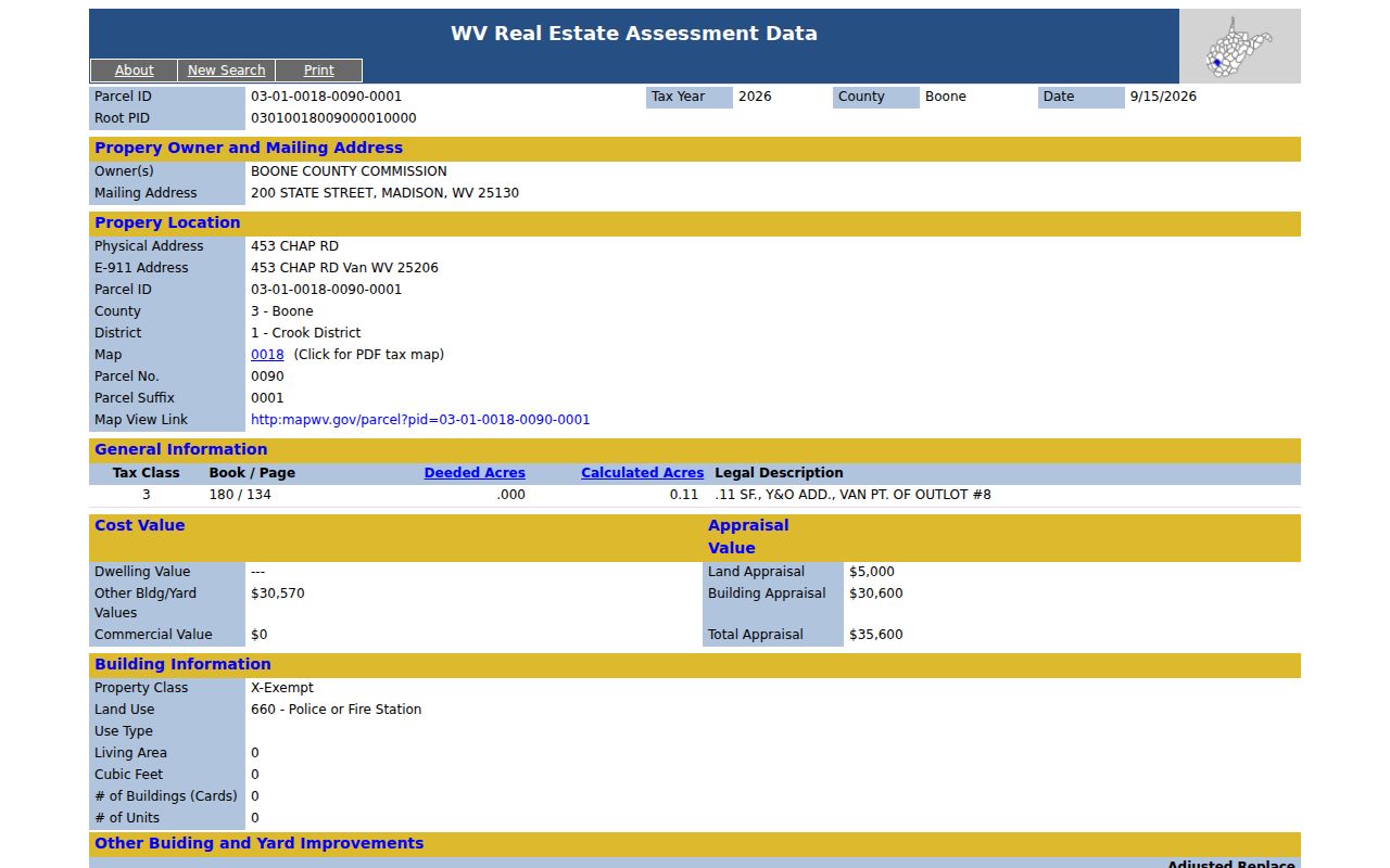
Only the deed and survey govern a legal boundary.
Madison Map 8 and Boone County Additions
The archived Madison Map 8 covers several Boone County additions. These include C&A Addition, Shields Addition, and Crawford & Ashby Addition. Streets named on it include Washington, Virginia, and Jackson Avenues plus Second and Third Streets. Civic landmarks include Madison Grade School, Madison Baptist Church, the Memorial Building, and the Fire Department. Older parcels often trace back to addition lots rather than modern street numbers. That makes the addition or deed lot a stronger search clue than an address.
A title block gives the aerial photograph year as 1960. The map date is October 31, 1963. The legend separates road and railroad rights-of-way, interior lot lines, deed lot numbers in parentheses, circled parcel numbers, and parcel hooks. The PDF carries the statement "For Tax Purposes Only." It can orient a property search and clarify a deed description. It is not a survey, though, and not a current subdivision approval.
Open the archived Madison Map 8 PDF when the deed description names an addition or lot.
Search the Boone County Clerk index and the Archives finding aid by addition name. Then compare the result against the current assessment parcel before relying on any boundary.
Boone County Parcel Lines Can Lag
Boone County parcel lines can lag behind the paperwork. The WV Property Viewer refreshes assessment data yearly, but a split may take longer to appear as parcel geometry. When a transfer runs from July 1 to June 30, assessors must file map revisions by February 1 of the next calendar year. The state says to contact the local assessor if a wrong line survives two years. A purchase deed can therefore post before any new polygon shows.
The state also separates deeded acreage from calculated acreage. Deeded acres come from the conveyance language. Calculated acres come from GIS geometry. One Madison parcel lists .698 deeded acres against .73 calculated. The state says the deeded figure controls for assessment. A large mismatch, stacked building geometry, or a missing card should go to Boone County mapping staff with the deed or survey attached.
Never settle a boundary with a flood overlay. A tax map line will not work either; flood zones can cross several lots, and tax map lines are reference features only. When a legal boundary is at stake, a licensed surveyor should reconcile the ground with the deed and plat.
Boone County GIS Downloads and Map Files
Free statewide files are another route. WV Property Assessment offers digital surface tax maps and GIS files at no charge through an authorized WV GIS Clearinghouse distribution site. Statewide files differ from a county PDF tax map. The Madison Map 8 PDF carries a tax-purpose and reproduction notice, so read its terms before copying or distributing. The statewide layer suits research or a GIS handoff. For a quick parcel lookup, the Assessment and Viewer pages remain the faster tools.
Save the date and source of any downloaded geometry. Annual data can differ from a fresh deed or a local correction. The same parcel may appear in several formats. Keep the full PID, tax map number, and legal description with the data layer. When a line is disputed, give Boone County mapping staff the deed, survey, or plat rather than an exported shape.
The statewide files live in one place. Visit the WV GIS Clearinghouse dataset page for statewide map and download information.
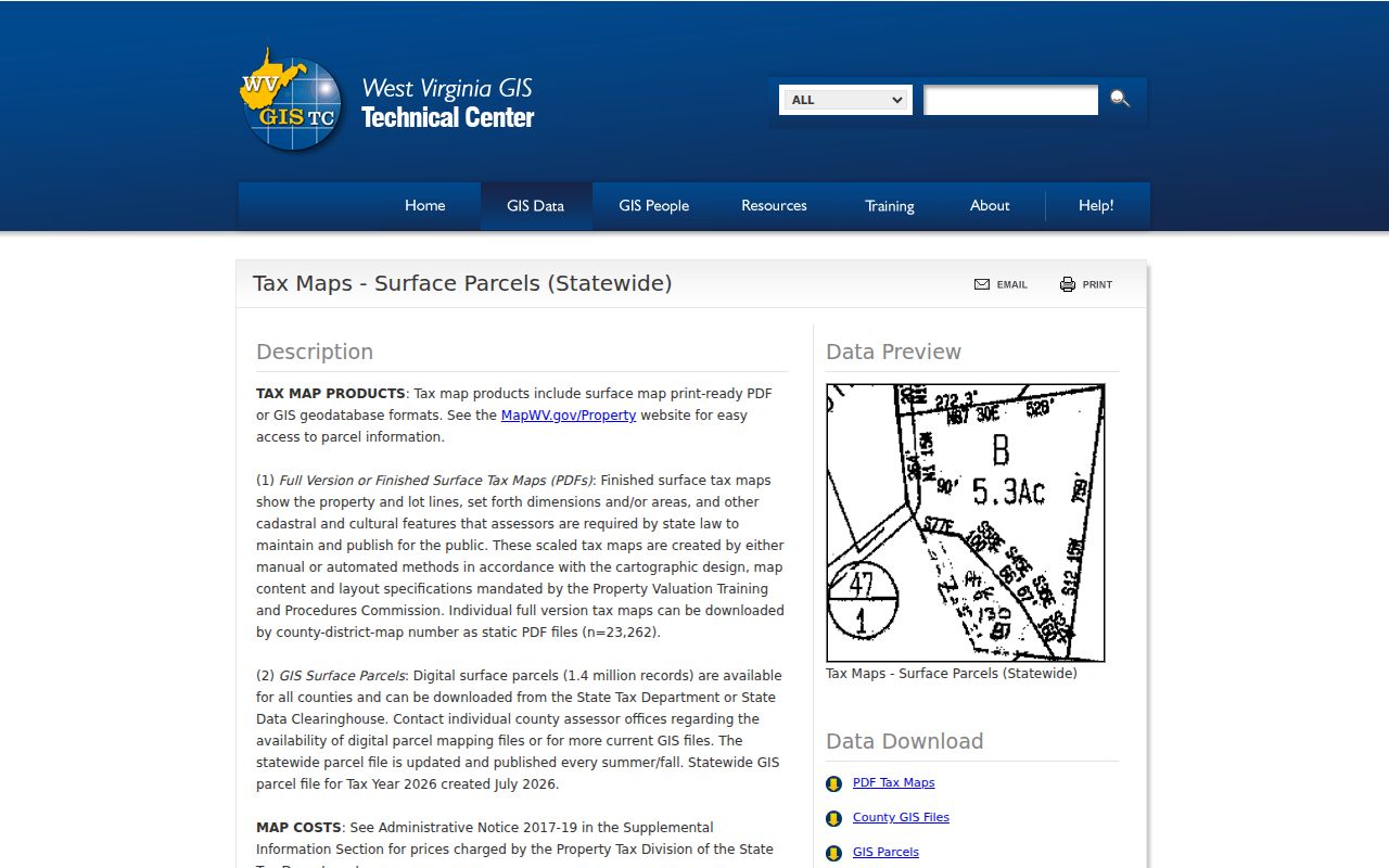
The Clearinghouse page handles the data route. For a correction to Boone County parcel geometry, the county assessor stays the local source.
What Boone County Parcel Maps Do Not Prove
Boone County parcel maps have real limits. The Viewer shows surface parcels only, not minerals. Its own notice calls the parcel lines a tax and reference visualization. Each polygon is a best-fit assembly. It is built from deed descriptions and survey information. That polygon will not prove ownership in court. It will not settle a fence, an easement, a road, or a lot corner either. A line on the ground takes a licensed surveyor plus the recorded instruments.
Calculated acreage comes from GIS geometry. It is not the legal acreage for assessment, and the state gives deeded acreage precedence when the two differ. A parcel can also carry stacked geometry or multiple cards that the Viewer never gathers into one panel. Contact Boone County mapping with the deed or survey when a line, an acreage figure, or a parcel card looks wrong.
Not a survey. Boone County GIS lines are for reference. Use a licensed survey and the recorded deed when a boundary, easement, or build location must be confirmed.